West Kenya Project
The West Kenya Gold Project (“WKGP”) is a proposed gold mining development comprising two key deposits: the Ramula-Mwibona and Isulu-Bushiangala deposits, both of which have NI 43-101-compliant Mineral Resource Estimates. These deposits are located approximately an hour drive on paved roads from Kisumu, Kenya’s third-largest city and the principal urban centre in western Kenya.
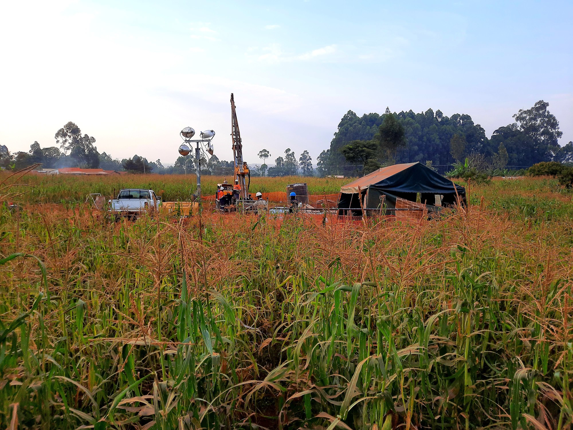
Project Development Timeline: During 2025, the feasibility study was completed, key regulatory approvals were obtained, and the project financing process has formally commenced, marking a major step toward project execution. The year also saw continued exploration activity and the initiation of selected early works programmes.
In 2026, the focus will be on advancing and concluding project financing, progressing the Resettlement Action Plan (RAP), and implementing further early works programmes to support construction readiness. In parallel, ongoing exploration at nearby satellite deposits, currently outside the life-of-mine (LOM) plan and feasibility study, is expected to provide additional upside and unlock further long-term value.
Mining Operations
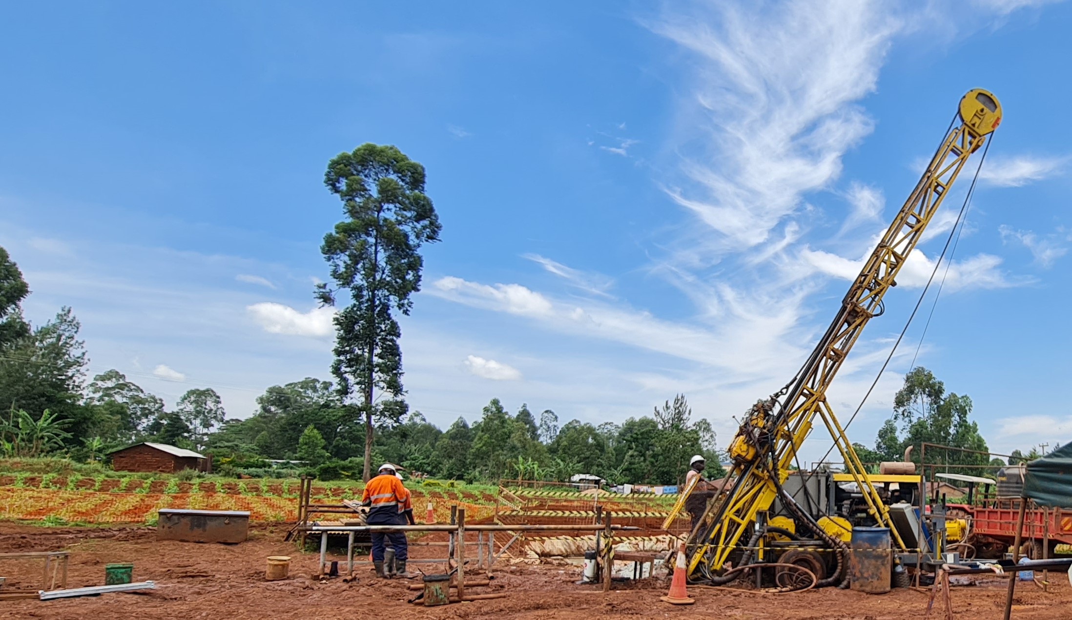
- Ramula-Mwibona Deposit: This will be developed as an open-pit mining operation following a contractor-mining model. The mining contractor will supply and operate all equipment, while Shanta Gold will retain responsibility for technical oversight, including mine design, planning, geological interpretation, and survey functions.
- Isulu-Bushiangala Deposits: Hosting a very high-grade resource, these deposits will be developed as underground mining operations using a mechanised longhole stoping method with cemented rock fill. All underground operations will be owner-operated by WKGP employees.
Processing: Ore from both deposits will be processed through conventional gold processing with proven metallurgical techniques, including crushing, milling, and carbon-in-leach (CIL) gold extraction, delivering robust recovery rates. Processing will have a throughput capacity of 915,000 tonnes per annum (tpa). Tailings will be managed through a single HDPE-lined dry-stack tailings storage facility (TSF), designed in line with global best-practice standards to minimise environmental impact.
Power Supply: The operation will be primarily powered by the national electricity grid, with standby diesel generators installed to ensure uninterrupted power supply during outages or grid instability.
Exploration and Growth: Since acquiring ownership of the West Kenya portfolio in late 2020, Shanta Gold has more than doubled the total mineral resources across its prospecting licences. Ongoing exploration activities continue to expand the project’s geological potential and lay the foundation for further growth beyond the current mine plan.Regional Geology
The Tanzania Craton forms the south-eastern extent of the Archaean Eastern Congo Craton, a 2,000 km long corridor, which extends from Tanzania in the south, northwest into the Central African Republic. The southern part of the Tanzania Craton is dominated by felsic Dodoma gneisses and granitoid rocks and local supracrustal Dodoma schist relicts (Kabete et al., 2012a). The northern part of the craton is composed of a Neoarchean granite-greenstone terrane of the Lake Victorian Goldfields (LVG), which provides the host environment for the gold deposits. The LVG comprises seven greenstone belts, Iramba/Sekenke, Nzega, Sukumaland, Kilimafedha, Musoma-Mara, Migori and Busia-Kakamega. Early workers recognised unifying stratigraphic themes within these greenstone belts.
The Busia-Kakamega Greenstone Belt lies on the northern edge of Lake Victoria extending northwest from Kakamega in Kenya, into Uganda. The belt comprises an overall northeast facing sequence of volcanic and sedimentary rocks intruded by granitoids. The oldest rocks are pre-2750 Ma Samia Hills Group in the west through the 2700- 2670 Ma Ndori group and 2670-2660 Ma Yala group, eastward into the 2660 Ma Kavirondo group (Sharp et al. 2016). The volcanic units, and their intrusive equivalents, include rocks of komatiitic, tholeiitic, calcalkaline and high potassium adakitic composition: the adakitic rocks within the Yala River group are intercalated with sandstone and conglomerate which has been included in the Kavirondo group in the past. The komatiitic suite hosted by the Ndori Group includes high-Mg basalts and ultramafic volcaniclastic rocks. The granitoids can be separated into two groups: an older calcic syn-volcanic suite predating deposition of the Kavirondo group sedimentary rocks and a younger circa 2650 Ma high potassium suite which post-dates the Kavirondo group. Most of the rocks throughout the Busia-Kakamega Greenstone Belt show remarkably little strain at the outcrop scale. Exceptions are occurrences of mafic volcanic meta-tectonites. Field relations suggest these meta-tectonites are passively intruded by the circa 2670 Ma Assembo granitoid, which provides a minimum age for this early deformation. Rocks of the younger Kavirondo group are locally folded and in places cut by a steep cleavage in outcrops. The inferred circa 2660 Ma age of the Kavirondo group provides a maximum age for this younger cleavage and a clear indication that there are at least two distinctive generations of structures in the belt. East-northeast faults are inferred across the belt from several lines of evidence. These faults are discordant features, most likely representative of younger deformation. The major structural grain of rocks in the central part of the belt is northeast, truncated by the north striking intrusive contacts of the circa 2655 Ma Maragoli and Mumias external batholiths.
Within the Busia Kakamega Belt two informal geological regions have been recognised, the Kakamega Dome in the northeast, a broad synclinal structure of volcano-sedimentary rocks and the Lake Zone in the southwest a northeast trending folded and thrusted volcano-sedimentary sequence.
Isulu and Bushiangala Deposits
Gold mineralisation at the Isulu and Bushiangala deposits is hosted by sheared pillowed to massive basalts, bounded between ultramafic volcanics and polymictic conglomerates on one side and carbonaceous mudstones and sandstones on the other side. The deposits occur within the Liranda Corridor area, a 12 km structural trend located on the eastern limb of a broad synclinal structure intruded in the center by granitoids and diorites, termed the Kakamega Dome. Mineralisation is associated with quartz and quartz-carbonate veinlets ranging from 0.5 m to 10 m in true width, which lies within the mineralised shear zones. The mineralisation style is classified as orogenic, shear-zone-hosted quartz-carbonate vein subtype.